27 December 2023
Waking up on a cold, windy ridge after a frigid night that shook the camper van, I felt we were quite alone. Only two other cars shared this Freedom Camp with us. It was a little disconcerting. Packing up is routine now, so it didn’t take us long to get going. A few minutes down the road were dozens of camper vans parked in a lot. Was that the Freedom Camping spot? Did we camp illegally? Perhaps…..
The road took us north around Lake Pukaki. Acres of burned forest stood in parched soil, the grass just starting to grow back. It’s clear some of this planted forest was caught in a fire that crossed the road several times. Must have been a bad one.
Next came a field of deep purple flowers: a Lavender Farm we decided to visit on our way back (where we would meet Oscar, Arthur and Astrid! But that’s another post). The call of the nearing snow capped peaks was strong!
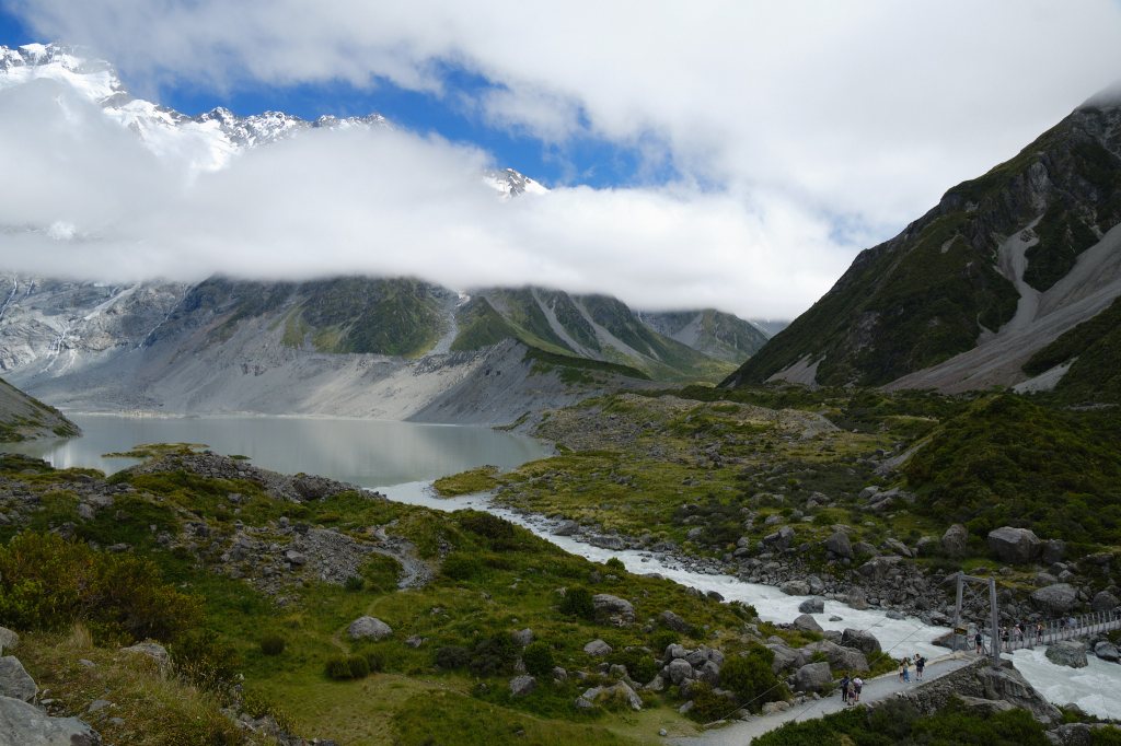
The north end of Lake Pukaki gives way to a wide valley. Two resorts with cabins and a multi story hotel were the first sign that this was a very popular destination. The DOC (Department of Conservation) campsite known as White Horse Hill was far less luxurious and much more our style. And right at this camp is the head of the famed Hooker Valley Track, one of the “must-do” tramps in New Zealand. But first we had to park…..
Upon our arrival at 10am the parking lot was already full, but Mike managed to squeeze us into one of the last remaining spots. The camp ground was a few steps away, but check in wasn’t until 2pm. There was no formal check in process: just a sign requesting to register online, or to fill out a paper form and pop it into a box. That worried us because we had made that online reservation months ago. If it was this hard to get a parking space, would we find a camping spot? And we really wanted to pack up and start our hike. What do to?
Listen to the words of a child. Yes, out of the mouths of babes. At the moment I was worrying about all of this I heard a little boy say “Mama, don’t worry. It’s only a walk!”. He was right. The walk was what we had come for. Not to worry. I thanked him for his wise words.
Dressing in layers, packing the pack with plenty of water and “pro-things to eat” we set off through the cool fog to the start of the track.
Several meters in were knew we were in for an extraordinary day.
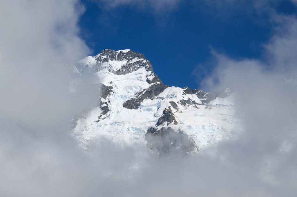
The clouds started to lift revealing what we thought was Mount Cook. Although the trail itself is very well maintained and easy to follow, there isn’t a lot of information about the natural surroundings. No maps and nothing to tell you how far you’ve gone and how much further it is to your destination (both Tongariro and Able Tasman were extremely well marked this way). Later, our new friend Maia told us that the DOC has everything online to print out. But for the moment, we just followed the crowd.
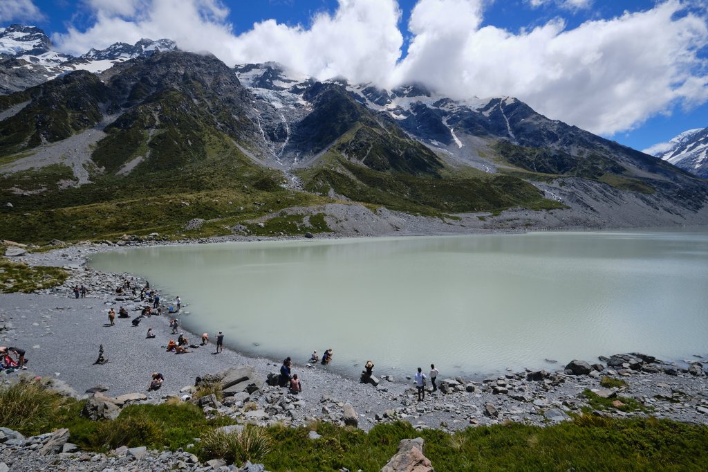
And there were A LOT of people. Of all ages and languages and abilities. And so much to see! We took our time. Stopping to look around at the short trees, the tufts of grass, the rocks and boulders, the hills of gravel crumbling off of the mountain, the clearing place blue sky. And the snow!! The clouds were lifting, the temperature warming, and the landscape was revealing itself.
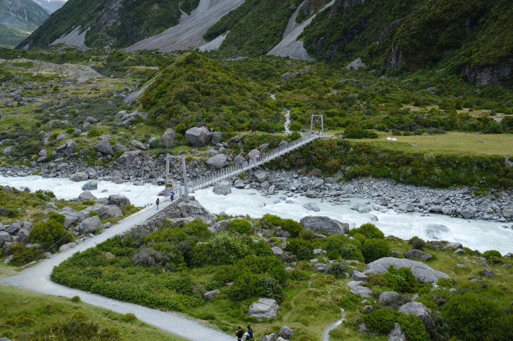
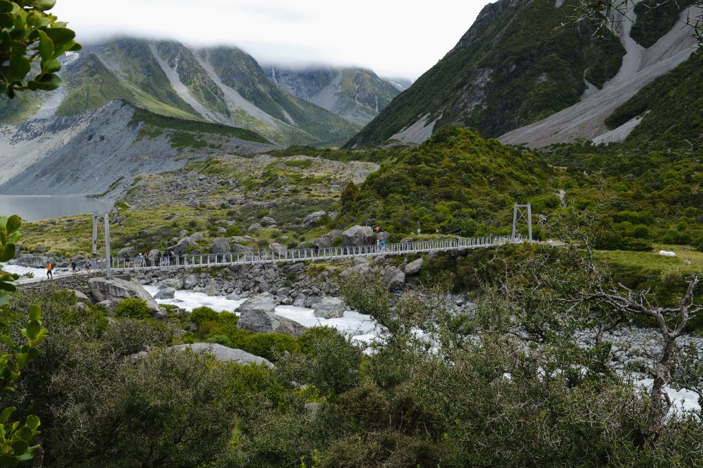
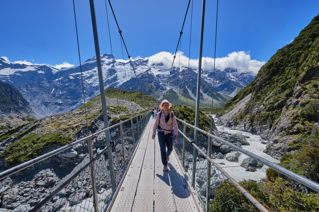
Our first suspension bridge was an experience. Over rushing waters of pale sage green it lead to the first of several glacial lakes. An exclamation point sign very clearly stated a limit of 20 people. But more than that were crossing. As we approached the bridge a woman very politely asked us if we could please wait. Her husband was on the other side of the bridge and was feeling extremely nervous about crossing with so many people. Could we wait until he was able to cross alone? Of course, we said. So we waited. And waited. A line formed behind us. Still no sign of him. Finally a hiker suggested perhaps she should cross with him. It might make him feel better. And the hiker promptly passed the woman onto the bridge. We followed. The bridge did wobble a lot! And I get it: anxiety isn’t an easy thing to deal with, especially over a roaring river. But it also felt very secure. The bridge wasn’t going anywhere. I hope the husband made it across OK.
Over the bridge, up onto a hill and the mountain revealed itself into all its glory! And a song came into my head and stayed there: The Hills are Alive with the Sound of Music. It looked and felt just like the Austrian Alps. I expected Julie Andrews to appear twirling in the grass at any moment.
Mike and I climbed up onto a rocky ridge. I found a nice rock and sat. Mike went further to catch pictures of the water falls. I gazed up at the mountain of snow and rock. I breathed the cool clear air. And then I saw it: an avalanche! A small one, but an avalanche for sure! Mike looked up at the sound of thunder, but missed the sight. I was very excited.
Throughout our 24 hours in the area we believe we heard 10 avalanches, and I saw 5 of them. One has to keep looking at the mountain, because once you hear the “thunder” the avalanche is over.
Hooker Valley track has steps, boardwalks covered with chicken wire for traction, one bathroom stop and well trodden paths of pale, firm soil. Not a difficult trail to hike.
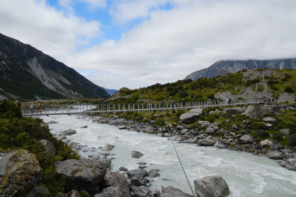
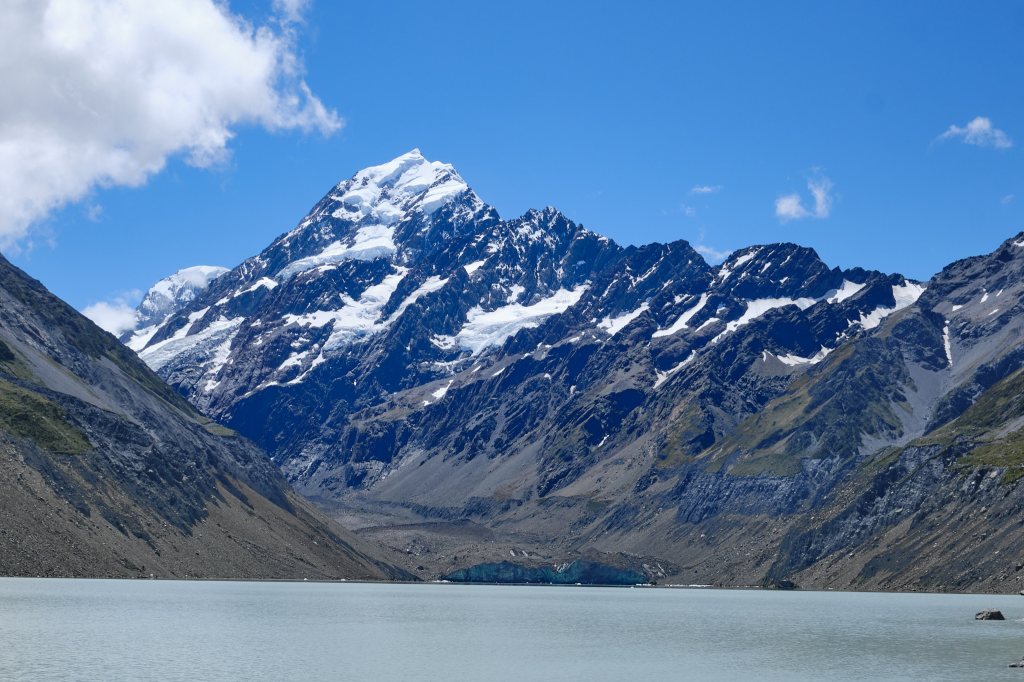
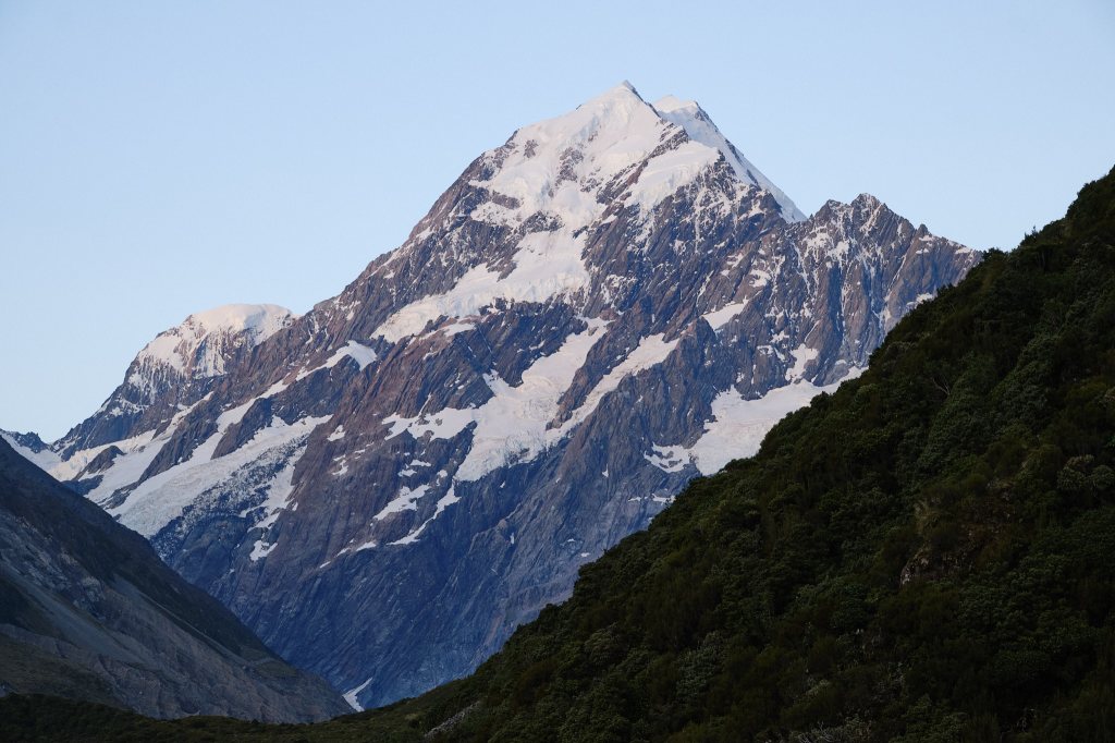
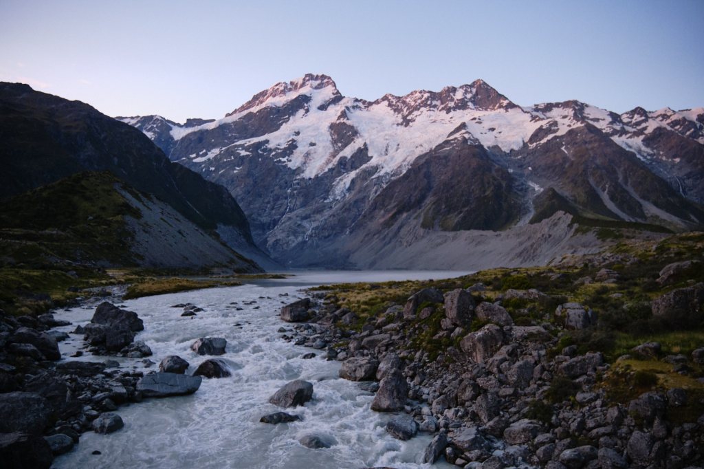
It wasn’t until we crossed the second suspension bridge that we saw IT: Aoraki, Mount Cook, the tallest peak in all of New Zealand. And it was STUNNING. Turns out that that other peak, was just a teaser! Two snow covered peaks filled the perfect bright blue sky. Snow melted into narrow waterfalls against rock of black and dark gray. Mike has taken lots of wonderful pictures. But being there was an un-capturable, breathtaking experience.
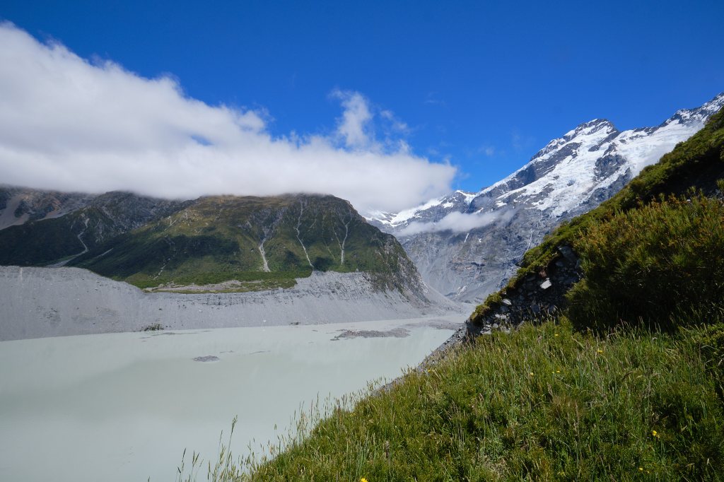
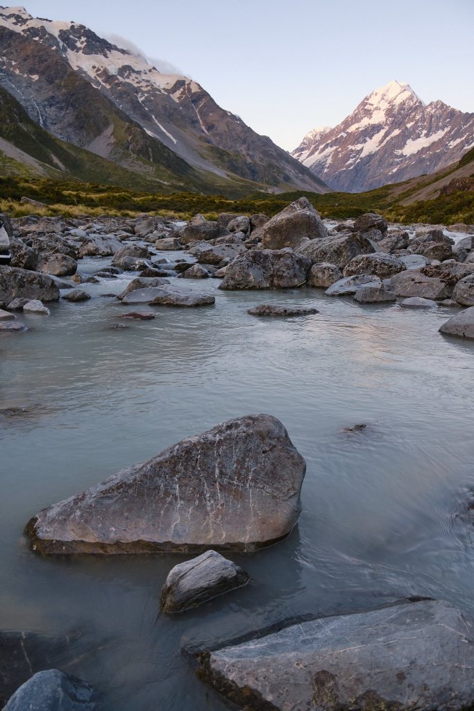
One more suspension bridge and the trail went up. Word was that we were close, and that the end was worth every step of the way. Up and then down, and we arrived at the rocky shores of a glacial lake: and there was the glacier! It was a flat shelf, covered in black dirt with a straight edge: like it had been cut to fit the valley. Tiny ice bergs could be seen at the wall where glacier and lake met.
The sun was full and shade sparse. Hundreds of people were picnicking. Some of them stripping to take a dip in the frigid milky gray water. They didn’t swim for long!
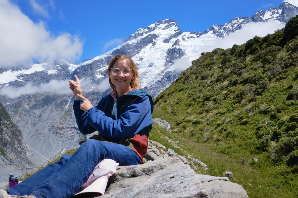
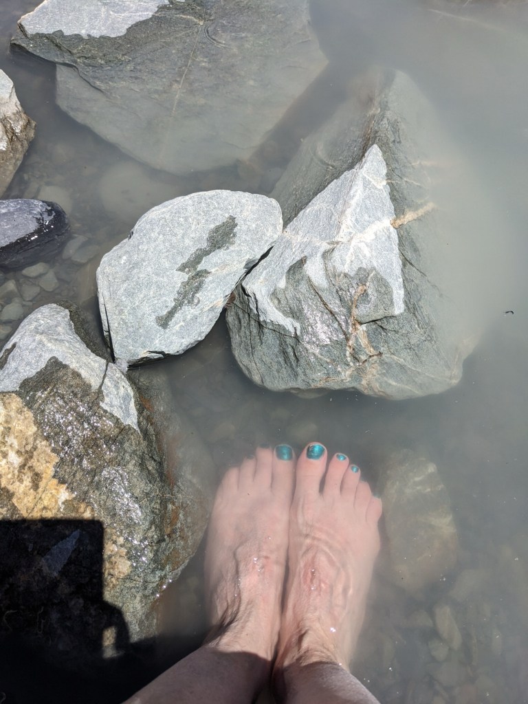
Mike and I spotted a large boulder at the edge of the lake that a couple was vacating. We claimed the spot our own, spreading our pack and lunch out on the 12 square inches of shade. Taking off my shoes and socks I dipped my toes into the water. Nice. I “baptized” myself by pouring water over my hair and face. It was the only “bath”I would have for days! What a spot!
I love trails that are “return” rather than “loops”. One always sees the landscape differently from the other direction. Mike and I tend to walk the return trip faster, knowing the way and being slightly less taken in by the views. My eyes were always on the peaks. I enjoyed spotting avalanches.
About 2/3 of the way back we noticed some kind of compass up on a rock. We climbed and found it was a way to identify the peaks. A large flat disc had the names of each peak etched into it. An arrow rotated in the center. Point the arrow and find the name. What we had been calling “Ellen’s Ridge”, because I had seen 4 avalanches on it was actually called “The Sharks Teeth”. A couple from New Jersey joined us up there to explore the device and we became fast friends. Maia and Dan assured us we would find a camp site. And in about 45 minutes we did: right near theirs!
The sun was high. We’d walked 10 kilometers. Cool air was blowing through Miranda the van. The Shark Teeth filled the back window of the van. I mean filled it! You cannot imagine how big this mountain is and how close to it we were.
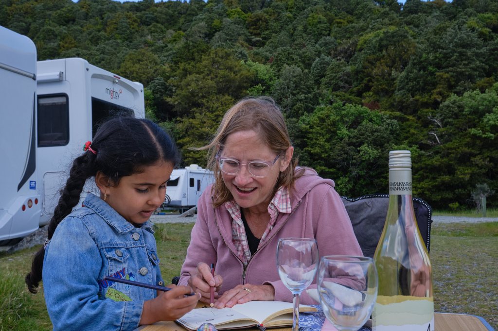
A nap, a dinner of 2 Minute Noodles (as Ramen is called here) and smoked salmon and we noticed a familiar big pink bus. We’d seen it at our Akaroa Holiday Park. The family and I did laundry together. The adorable little girl recognized me. Soon she was at our picnic table with her father and we were all chatting. Mawaba is 5 years old. We drew a picture together. Her parents and big brothers emigrated from Iraq 14 years ago and her dad refurbished the pink bus himself. They travel this way every year.
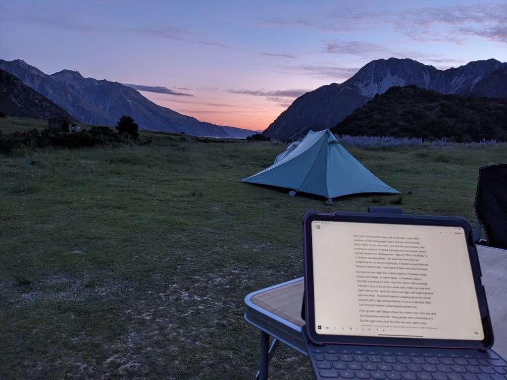
The sun was setting and Mike had a picture of Mount Cook in mind. So we set off up the Hoover Valley Track again! I turned back just after the first bridge, but he walk to the second and got a great shot! It was almost dark when he returned to find me sitting outside, watching the fading pink sky, with a cup of warm Milo (like Ovaltine) and this iPad, writing the two-days-ago post.
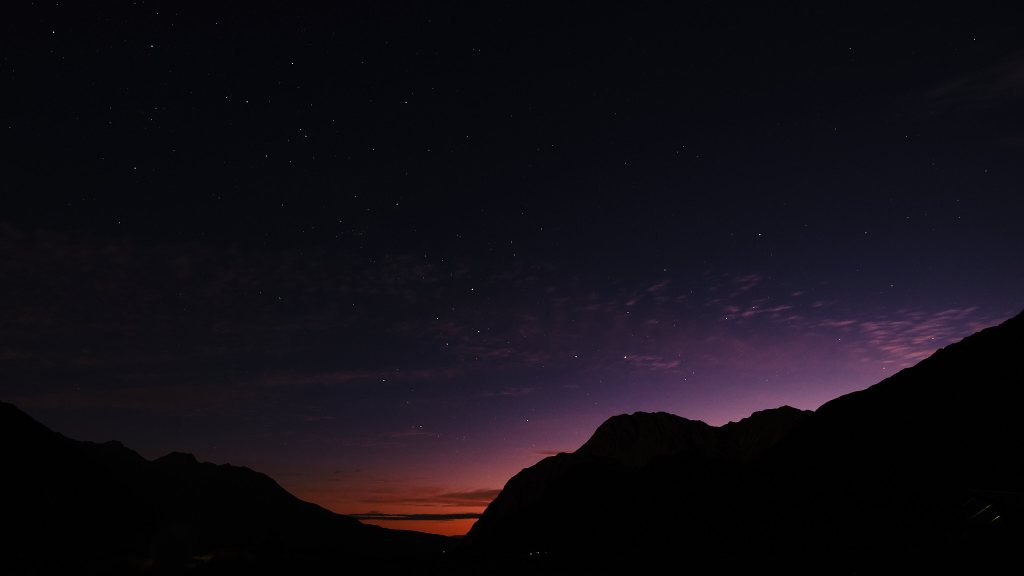
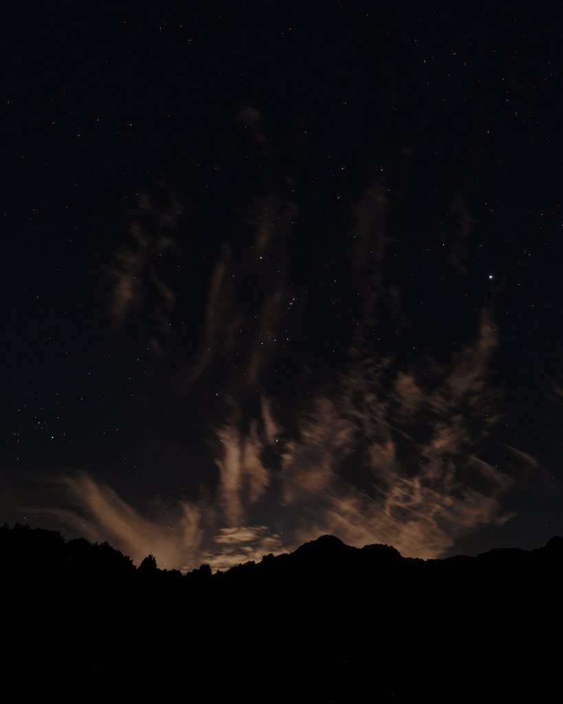
Maia and Dan joined us to watch the stars. This is one of the darkest places on earth, but the full moon was rising. Still, with Maia’s handy star mapping app there was plenty to see.
These two have been traveling the world for over a year. We connected immediately as we have much in common. If you are reading this: you are WONDERFUL! Please keep in touch.
It was well past midnight when we all finally turned in. The Sharks Teeth of Mount Sephton still glowing in the moonlight.


Leave a comment